Southeast Alaska Photos
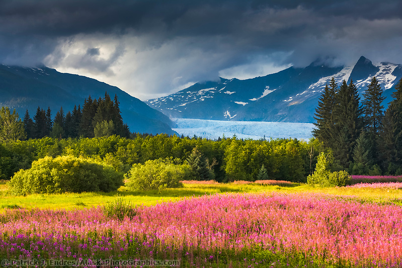
Clouds over the Coast Mountains and the Mendenhall Glacier, fireweed in full bloom in Brotherhood Park, Juneau, Alaska. (Patrick J Endres / AlaskaPhotoGraphics.com)
Southeast
The Southeast Alaska photos below present a region of Alaska famous for its tremendously lush forested island and inland water passages that weave through the great panhandle. Most towns in southeast Alaska are accessed by plane or Alaska marine ferry, as no commercial roads will take you there. These towns have become popular destinations for tourists aboard large cruise ships that make stops along their journey north. The photos below can be licensed for commercial use or purchased as fine art prints for your home or office. Click on the respective images and links for purchase information.
- Search Skagway Alaska Photos
- Search Haines Alaska Photos
- Search Juneau Alaska Photos
- Search Sitka Alaska Photos
- Search Ketchikan Alaska Photos
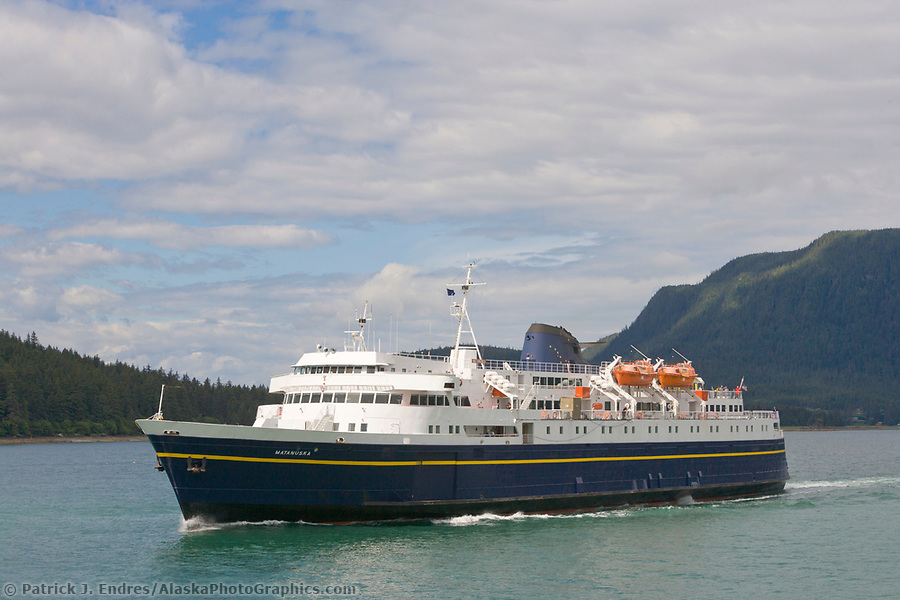
Alaska marine ferry MV/Matanuska in Lynn Canal, near Auke Bay, Southeast Alaska (Patrick J. Endres / AlaskaPhotoGraphics.com)
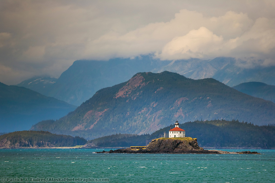
Scenic Southeast Alaska photos like Eldred Rock lighthouse dot the waters along the Chilkat Mountain range, Sullivan Island, Lynn Canal, Alaska inside passage. Eldred Rock light is the oldest surviving lighthouse in Alaska, built in 1905. (Patrick J Endres / AlaskaPhotoGraphics.com)
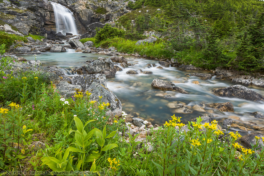
The mountain stream in White Pass Summit at the border between Alaska and British Columbia along the Klondike highway leads to the historic gold rush town of Skagway, Alaska, on the Lynn Canal. (Patrick J. Endres / AlaskaPhotoGraphics.com)
Skagway
Skagway, located at the end of the Lynn Canal, used to be Alaska’s largest city in 1989, with 10,000 people. Today, about 900 people make up the population which booms in the summer months due to the popularity of the historic city as a cruise ship tourist destination. The town is accessible by road and railway, specifically the Historic White Pass and Yukon Route narrow gauge iron trail, which was born of the 1898 Klondike Gold Rush and built through some of the North’s most ruggedly beautiful terrain. Refurbished train cars take passengers along the original route of the hopeful gold rush stampeders of 1898.
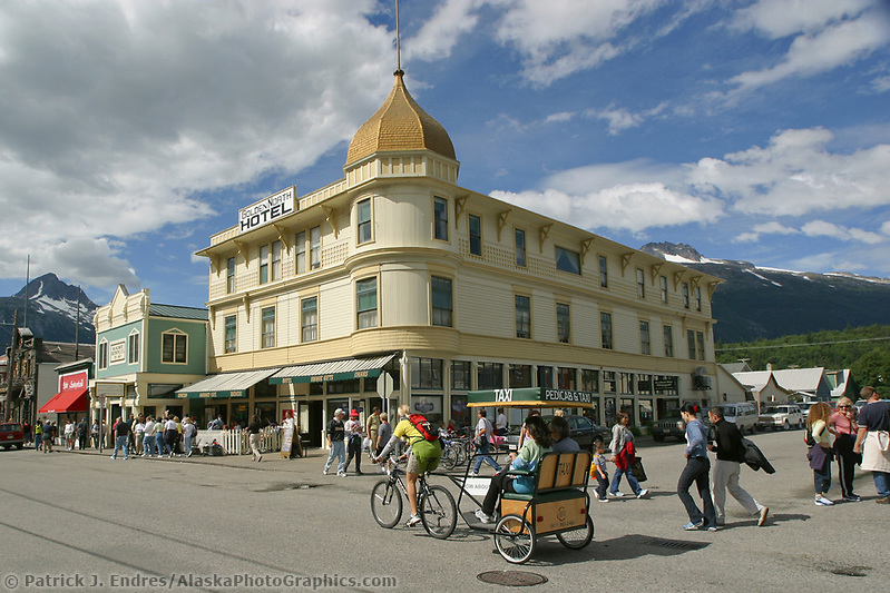
Skagway Alaska, Golden North Hotel, in the historic gold rush town of Skagway, Alaska, end of Alaska’s inside passage Lynn Canal. (Patrick J. Endres / AlaskaPhotoGraphics.com)

Skagway town tour driver dressed in clothing of the early gold rush days in Skagway, Alaska. (Patrick J. Endres / AlaskaPhotoGraphics.com)
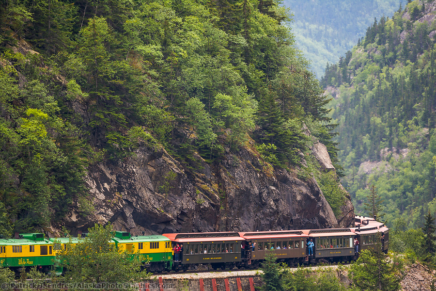
Historic White Pass and Yukon Route narrow gauge iron trail was born of the 1898 Klondike Gold Rush and built through some of the North’s most ruggedly beautiful terrain. Refurbished train cars take passengers along the original route of the hopeful gold rush stampeders of 1898, Skagway, Alaska (Patrick J. Endres / AlaskaPhotoGraphics.com)
Haines
Haines is located on the shores of the Lynn Canal between Juneau and Skagway, on the northern portion of the Alaska panhandle. It is one of the few southeast communities accessible via road. The majestic Chilkat Mountains flank the town. Attractions include wildlife, outdoor adventure, fishing, hunting, the American Bald Eagle Foundation and respective Bald Eagle festival, and native culture.
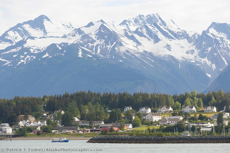
The coastal town of Haines, Alaska, inside passage at the end of the Lynn Canal. (Patrick J. Endres / AlaskaPhotoGraphics.com)
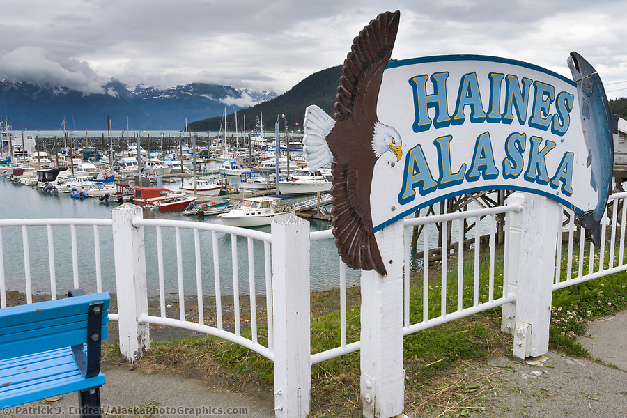
Haines, Alaska, town harbor sign. (Patrick J. Endres / AlaskaPhotoGraphics.com)
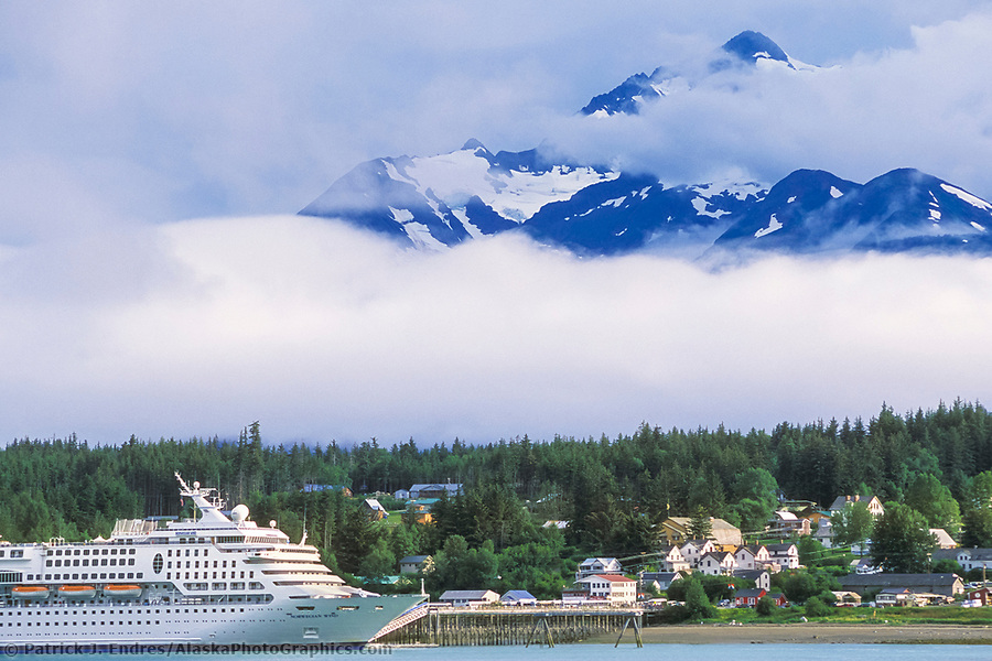
Norwegian Cruise Ship, coastal town of Haines, Alaska, at the end of the Lynn Canal, inside passage. (Patrick J. Endres / AlaskaPhotoGraphics.com)
Juneau
Juneau is Located on the Gastineau Channel on the Alexander Archipelago. It has been the capital of Alaska since 1906 when the government of the then-Alaska Territory was moved from Sitka. Juneau is only accessible by sea or air, with no road access. It sits at sea level and is flanked by steep mountains and glaciers, including the Mendenhall Glacier.
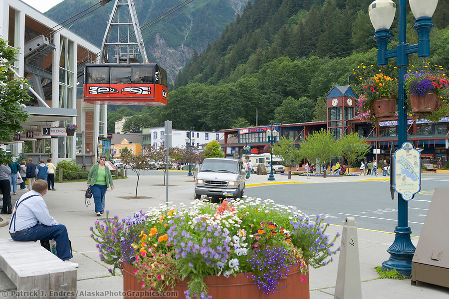
Mount Roberts tram, downtown Juneau, Alaska. (Patrick J. Endres / AlaskaPhotoGraphics.com)
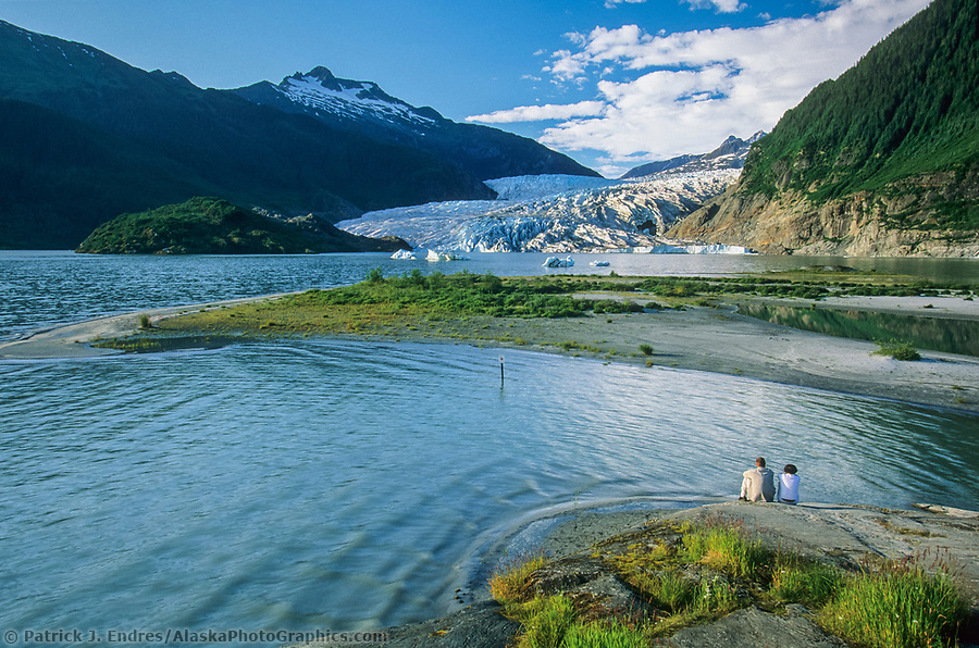
Mendenhall Glacier, located just outside Juneau, Alaska, is 12 miles long and 1.5 miles wide and extends from the Juneau Ice Field to Mendenhall Lake. A popular tourist attraction due to easy accessibility. (Patrick J. Endres / AlaskaPhotoGraphics.com)
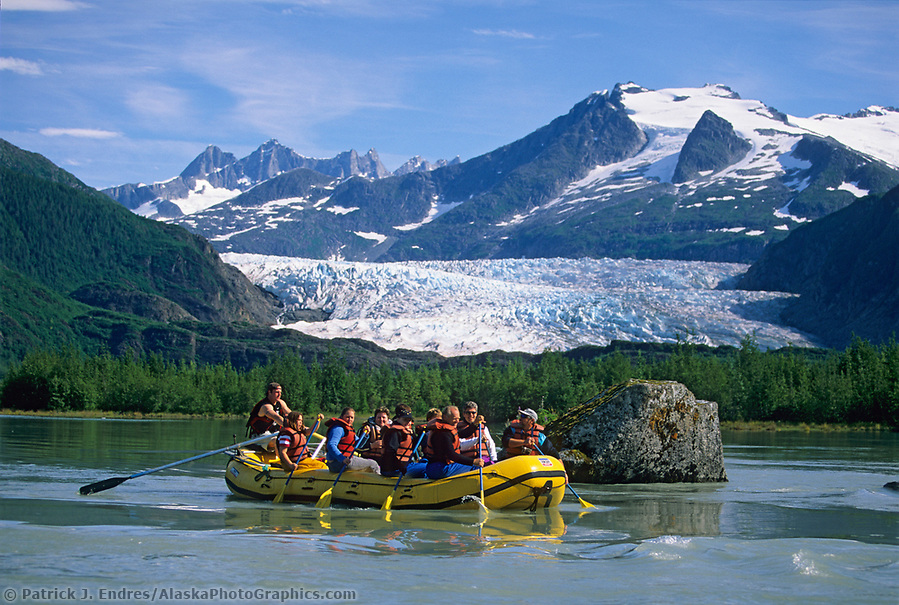
Whitewater Rafting, Mendenhall Lake, and River, icebergs from Mendenhall Glacier, Juneau, Alaska (Patrick J. Endres / AlaskaPhotoGraphics.com)
Sitka
Situated on the west side of Baranof Island, Sitka is flanked on the east by snow-capped mountains and on the west by the Pacific Ocean. Southeast Alaska photos of this quaint and popular seaside community are highly favored since it embodies a classic Alaska community with a unique history. Sitka National Historical Park preserves and interprets the site of a Tlingit Indian Fort, and the battle fought between the Russians and the Tlingits in 1804. Sitka is also central to the commercial fishing industry, which includes the Sac Roe Herring fishery. See the Sitka photos page for more information.
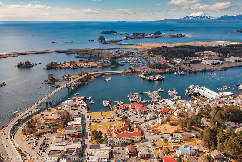
Aerial of downtown Sitka, overlooking Sitka Sound and the O’Connell bridge that joins Baranof Island with Japonski Island, Southeast Alaska. (Patrick J. Endres / AlaskaPhotoGraphics.com)
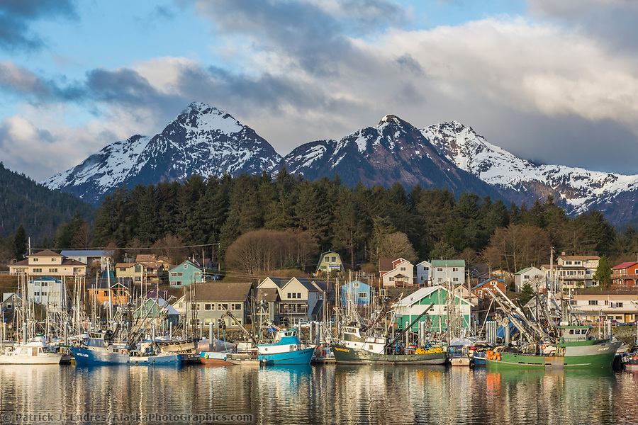
Commercial fishing boats in the Sitka harbor, Sitka, Alaska. (Patrick J Endres / AlaskaPhotoGraphics.com)
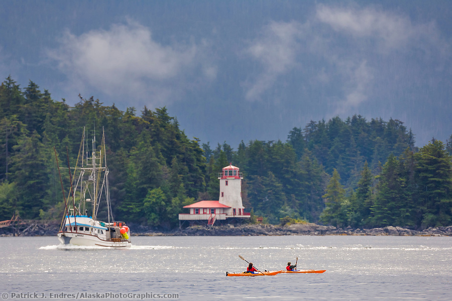
Kayakers paddle Sitka sound near the Rockwell lighthouse, a famous historical icon of the coastal town of Sitka, Alaska, in Alaska’s southeast panhandle. (Patrick J. Endres / AlaskaPhotoGraphics.com)
Ketchikan
Ketchikan, known as the Salmon capital of the world, is five hundred miles north of Seattle. It is Alaska’s “first city” and serves as the first port of call for many cruise ships visiting the state. The population of Ketchikan is approximately 8,000 people. Tourism and fishing are the primary industries in the city. Many visitors enjoy the historic downtown Ketchikan area and view totem poles in various locations, including Totem Bight and Saxman Village. Please visit my Ketchikan photos page for more information.
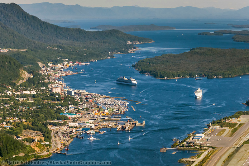
Cruise ship in Tongass Narrows and Ketchikan, southeast Alaska. Ketchikan International Airport (Patrick J. Endres / AlaskaPhotoGraphics.com)
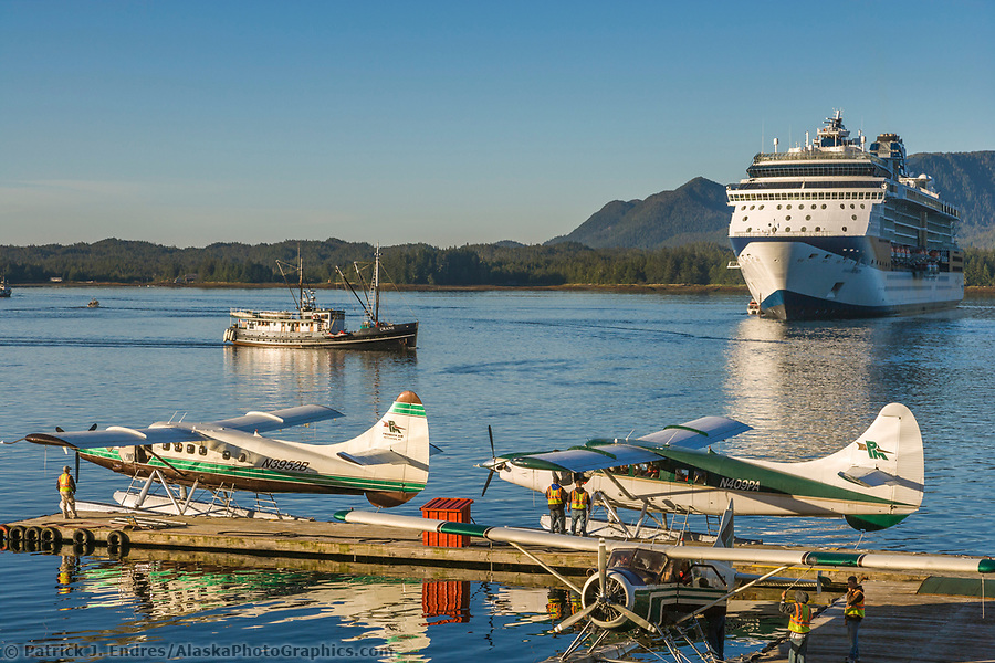
Tourists board float planes for flightseeing near Ketchikan, southeast Alaska. (Patrick J. Endres / AlaskaPhotoGraphics.com)
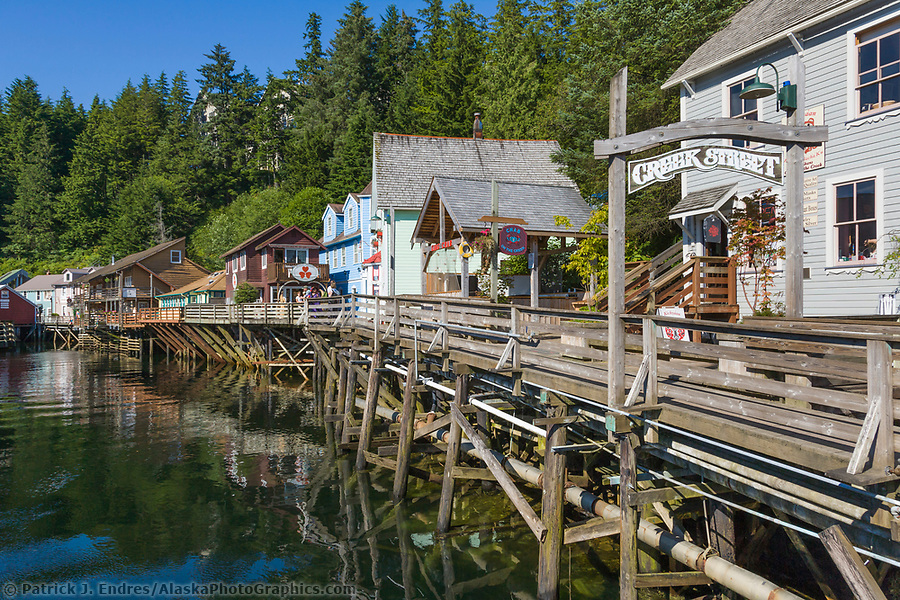
Famous Creek Street in downtown Ketchikan, southeast Alaska. (Patrick J. Endres / AlaskaPhotoGraphics.com)