Gates of the Arctic National Park photos
A mountain lake begins to melt in Oolah Pass, Brooks Range, Gates of the Arctic National Park, Alaska. (Patrick J Endres / AlaskaPhotoGraphics.com)
Gates of the Arctic
Alaska’s Gates of the Arctic National Park and Preserve is the farthest north Park, and second-largest in the nation, totaling 8.4 million acres. It is not only huge but also extremely remote and rugged. All the Gates of the Arctic National Park photos and those in the related links and galleries are available for purchase as stock photography for commercial use or as fine art prints to display in your home or office.
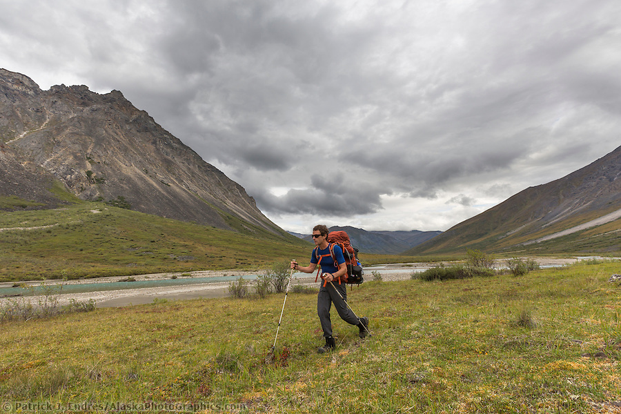
Accessing the Park
The Park is one of my favorite photography areas, full of dramatic scenery and pure rugged wilderness. But getting there can be tricky since there is no road access. But don’t be dissuaded, since the rewards are high and you will experience incredible beauty, far from the crowds of many travel destinations. There are a few places along the Dalton Highway where you can walk into the Park, but it is most easily achieved by bush plane. Check out this helpful resource on responsibly enjoying the outdoors and using the National Parks.
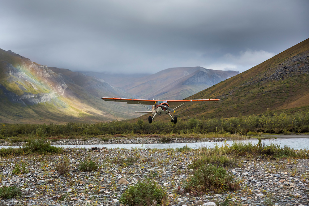
Bush plane approaches landing, Noatak River, Gates of the Arctic National Park, Alaska (Patrick J Endres / AlaskaPhotoGraphics.com)
Arriegetch Peaks
If you want a mind-blowing experience with natural beauty and ruggedness, then put the Arrigetch Peaks on your list. I’ve made several trips there, requiring some aggressive backpacking, but well worth the effort. Of all of the Gates of the Arctic National Park photos I’ve taken, this region has delivered some of my favorites.
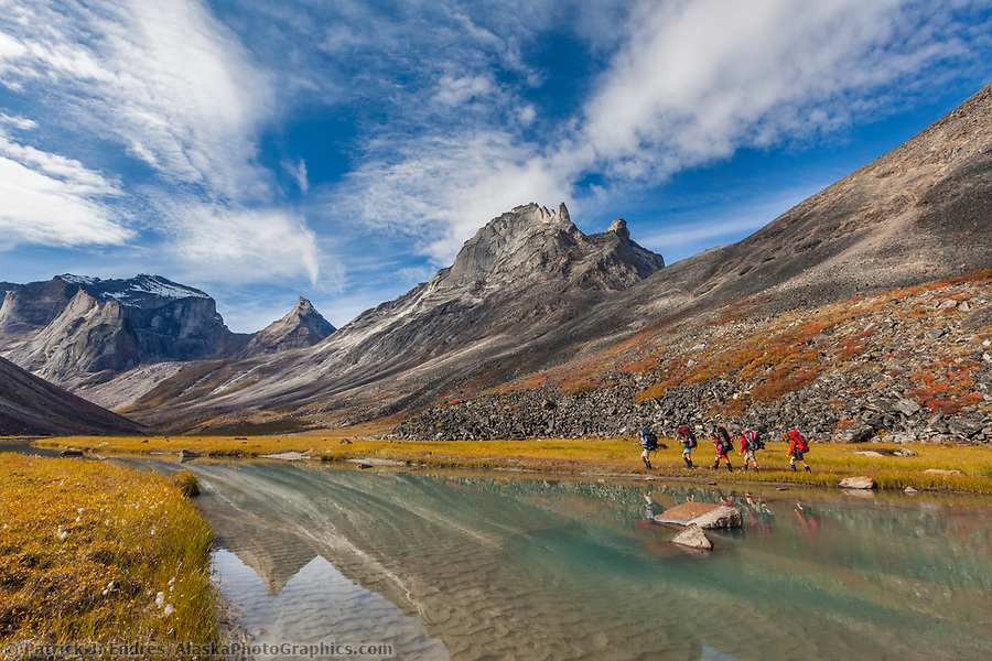
Five backpackers trek along the shore of Arrigetch Creek, with Xanadu, Arial, and Caliban peaks in the background. Gates of the Arctic National Park, Brooks Range, Alaska. (Patrick J. Endres / AlaskaPhotoGraphics.com)
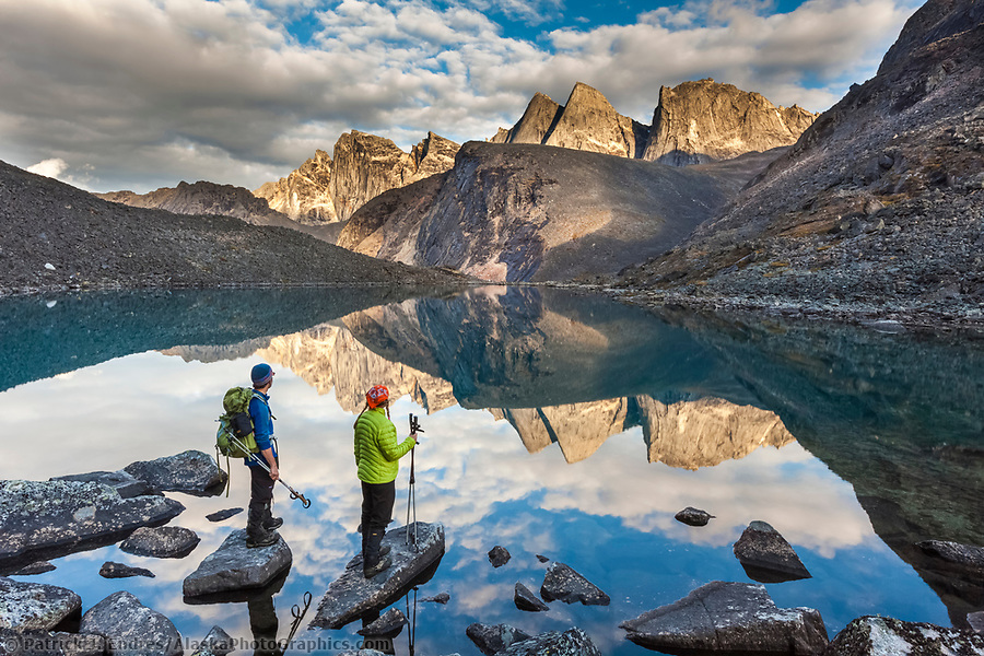
Hikers view Camel peak reflecting in a mountain lake in the Arrigetch Peaks, Gates of the Arctic National Park, Alaska. (Patrick J Endres / AlaskaPhotoGraphics.com)
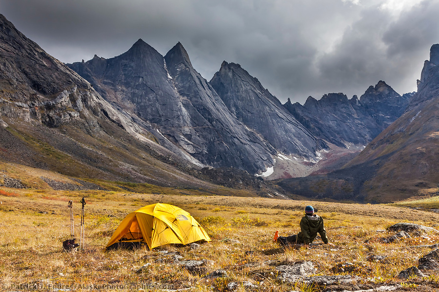
Backpackers enjoy a campsite on the autumn tundra with a view of East and West Maiden and Camel peaks in the distance, Arrigetch Peaks, and Gates of the Arctic National Park, Alaska. (Patrick J Endres / AlaskaPhotoGraphics.com)
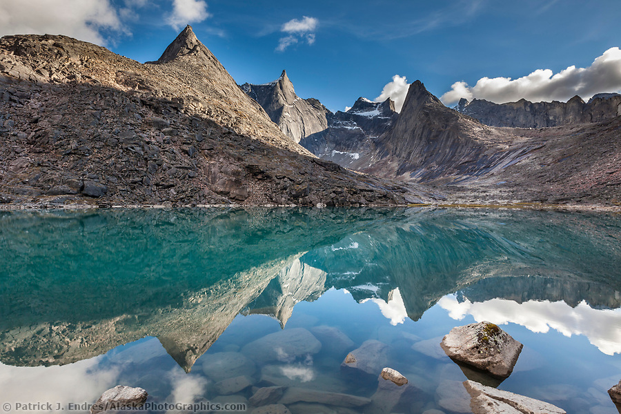
Dramatic granite spires of the Arrigetch Peaks reflect in the mirror calm mountain lake, Gates of the Arctic National Park, Alaska. (Patrick J Endres / AlaskaPhotoGraphics.com)
Noatak
The Noatak River region is one of North America’s largest mountain-ringed river basins with an intact ecosystem. The river is classified as a national wild and scenic river and offers dramatic wilderness float-trip opportunities. In the headwaters area, great hiking can be found in the adjacent mountains.
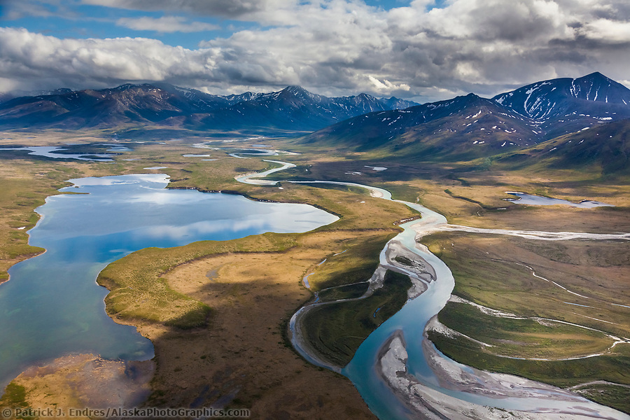
Aerial of Lake Matcharak and the Noatak River in the Brooks Range, Gates of the Arctic National Park, Alaska. (Patrick J. Endres / AlaskaPhotoGraphics.com)
Gates of the Arctic National Park, Alaska
Mt. Igikpak
Mount Igikpak is the highest peak in the Schwatka Mountains region of the Brooks Range. It is the tallest mountain in Gates of the Arctic National Park, with a summit estimated at 8,510 feet. The peak has a unique and rocky spire construct and is often obscured in clouds.
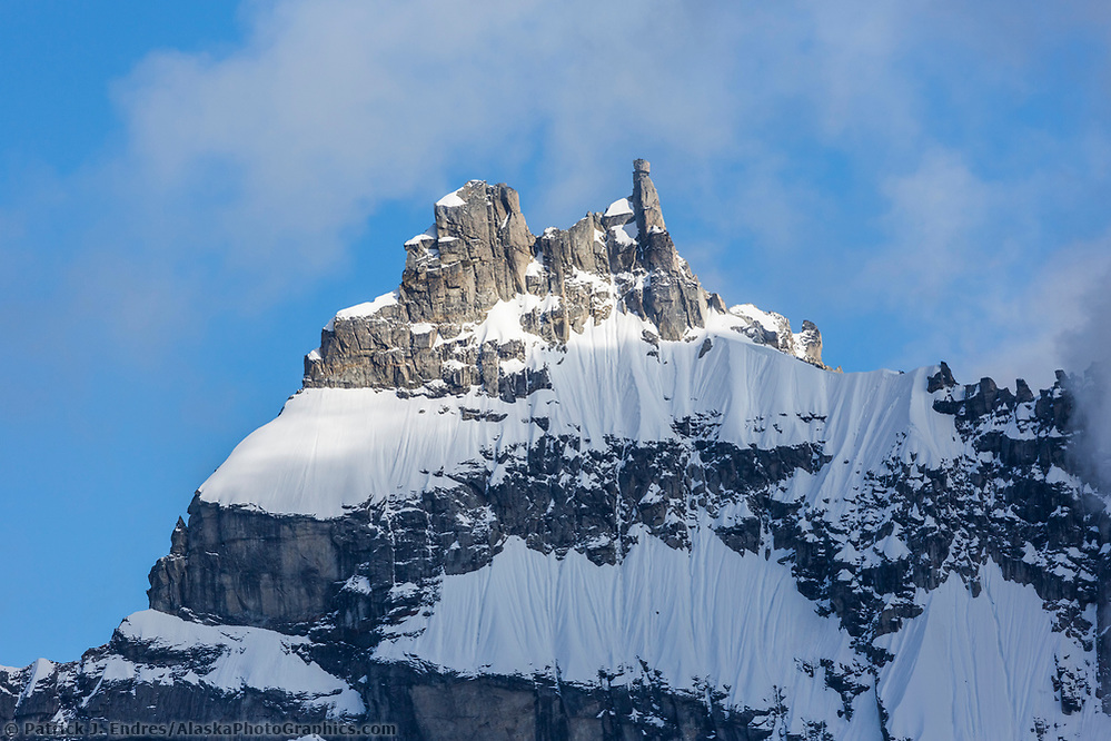
Mt. Igikpack, Gates of the Arctic National Park, Alaska (Patrick J Endres / AlaskaPhotoGraphics.com)
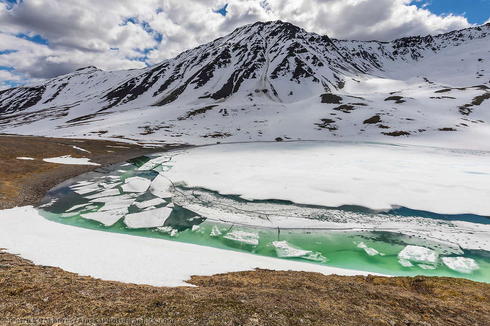
Oolah Pass
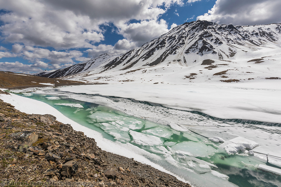
A mountain lake begins to melt in Oolah Pass, Brooks Range, Gates of the Arctic National Park, Alaska. (Patrick J Endres / AlaskaPhotoGraphics.com)
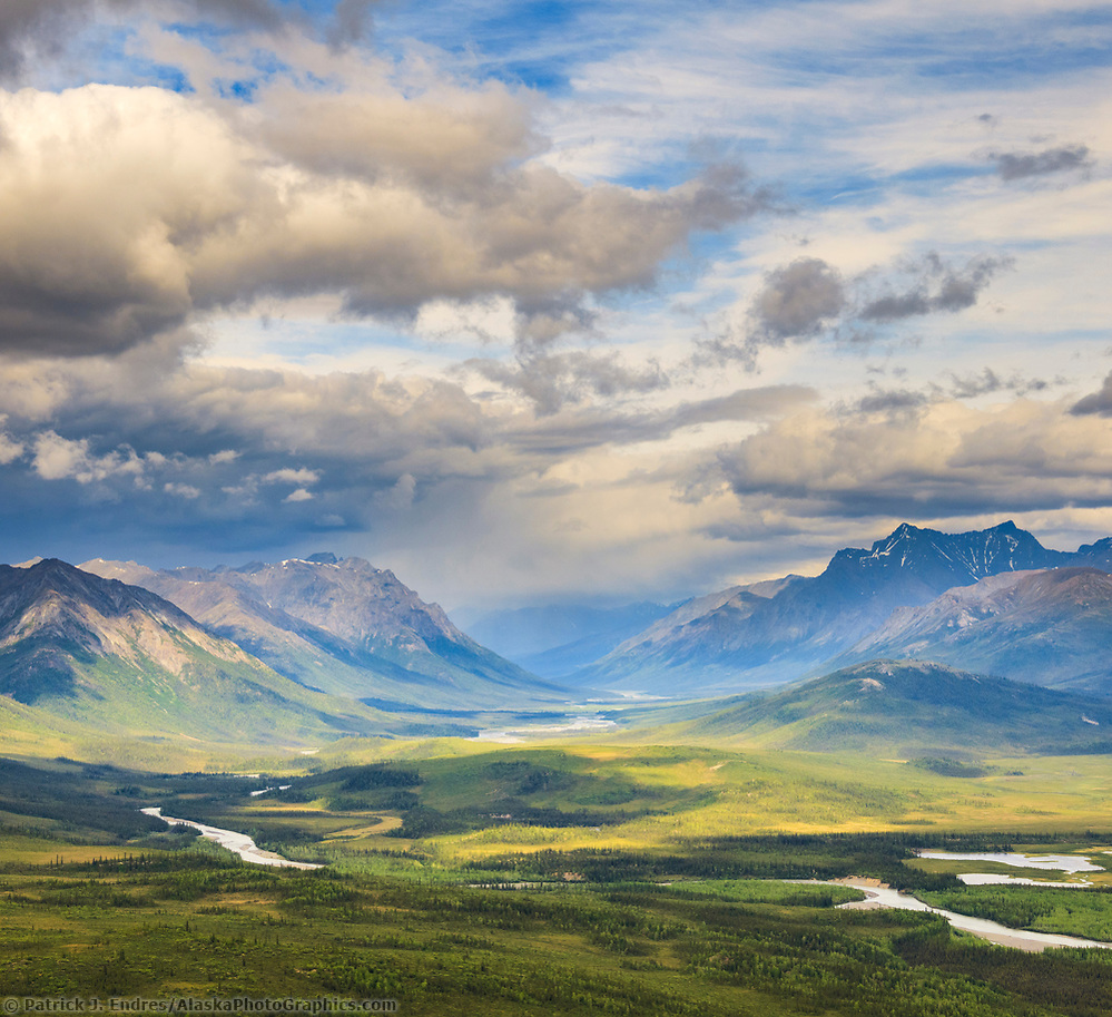
Rivers in the Gates of the Arctic
Many rivers flow through the Gates of the Arctic, and several are designated Wild and Scenic rivers. Floating them is a fantastic way to encounter Alaska’s wilderness.
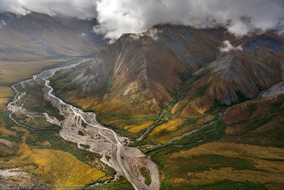
Itkillik River, Brooks Range mountains, Gates of the Arctic National Park, Alaska. (Patrick J. Endres / AlaskaPhotoGraphics.com)
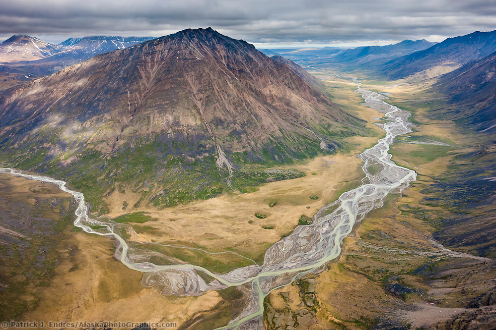
Okokmilaga River flows north of the Brooks Range mountains through the Gates of the Arctic National Park, Alaska. (Patrick J Endres / AlaskaPhotoGraphics.com)
Naming the Park
The Park’s name came from wilderness advocate Robert Marshall, who traveled the North Fork Koyukuk country frequently from 1929 to 1939. Marshall called two peaks, Frigid Crags and Boreal Mountain, the gates from Alaska’s central Brooks Range into the far north Arctic.
Frigid Craigs and Boreal Mountain flank the North Fork, Koyukuk River, Gates of the Arctic National Park, Brooks Range, Alaska. (Patrick J Endres / AlaskaPhotoGraphics.com)