Brooks Range Mountains
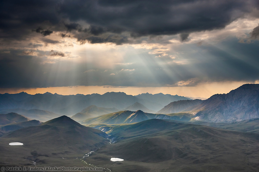
Aerial of dramatic clouds spilling light over the Philip Smith mountains in the Arctic National Wildlife Refuge, Brooks Range mountains, Alaska. (Patrick J Endres / AlaskaPhotoGraphics.com)
Alaska’s Northernmost Mountains
All Brooks Range Mountains photos on this site are available as stock photography for commercial licensing or fine art prints for home and office decor. The brooks range stretches 700 miles from west to east across northern Alaska into Canada. While mostly uninhabited and not accessible by road, the range is transected by the Dalton Highway and Trans-Alaska Oil Pipeline, passing through Alaska’s highest roadway pass, Atigun Pass, and on to the North Slope and Prudhoe Bay.
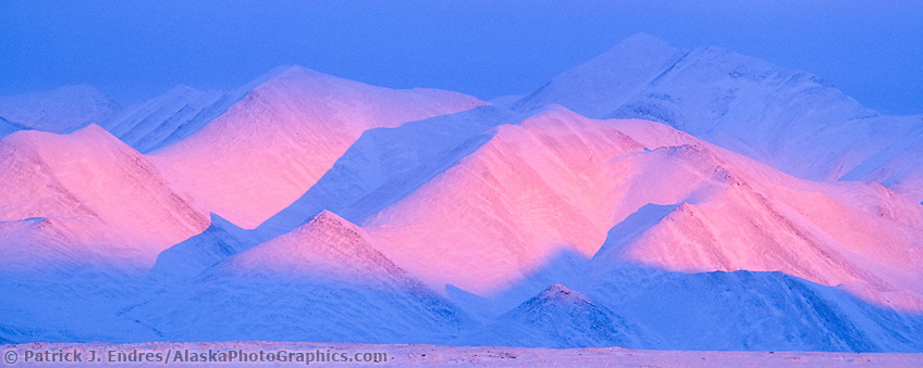
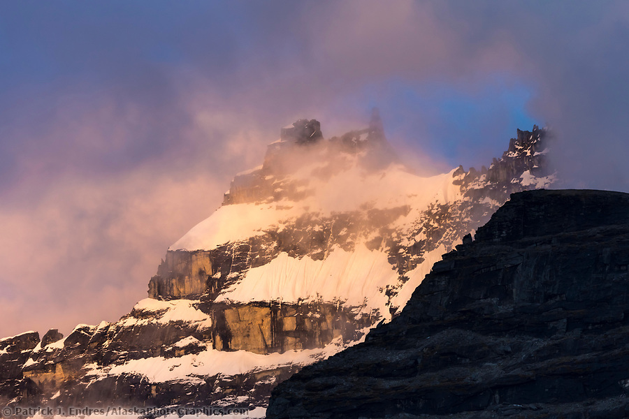
Pink alpenglow on the Philip Smith mountains of the Brooks Range, Arctic, Alaska. (Patrick J. Endres / AlaskaPhotoGraphics.com)
Subdivisions
The Brooks Range is subdivided into smaller sections of mountains with different names. The Philip Smith Mountains, the Endicott Mountains, the Romanzof Mountains to the north and east, the Davidson Mountains, and the Baird Mountains to the west, to name a few. However, they are part of the more extensive Brooks Range, which creates the northernmost continental divide of the United States.
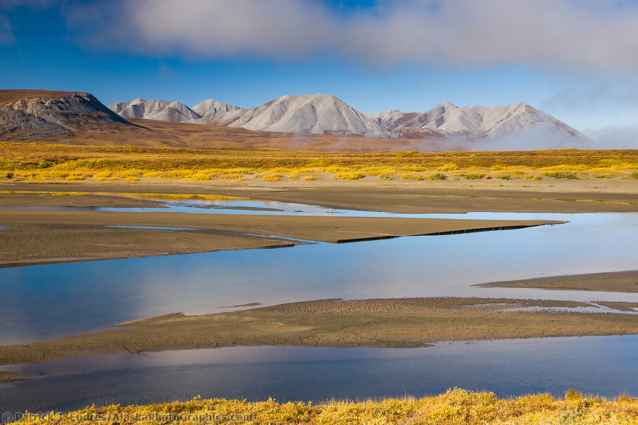
Romanzof Mountains
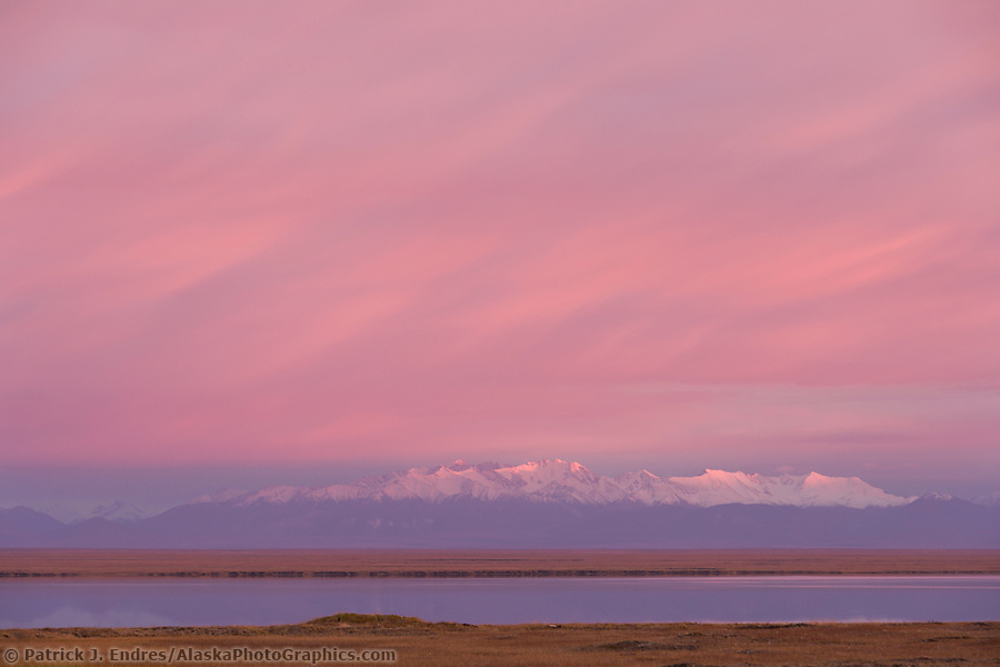
Romanzof mountains of the Brooks Range in the Arctic National Wildlife Refuge, view from Barter Island south to the refuge. (Patrick J. Endres / AlaskaPhotoGraphics.com)
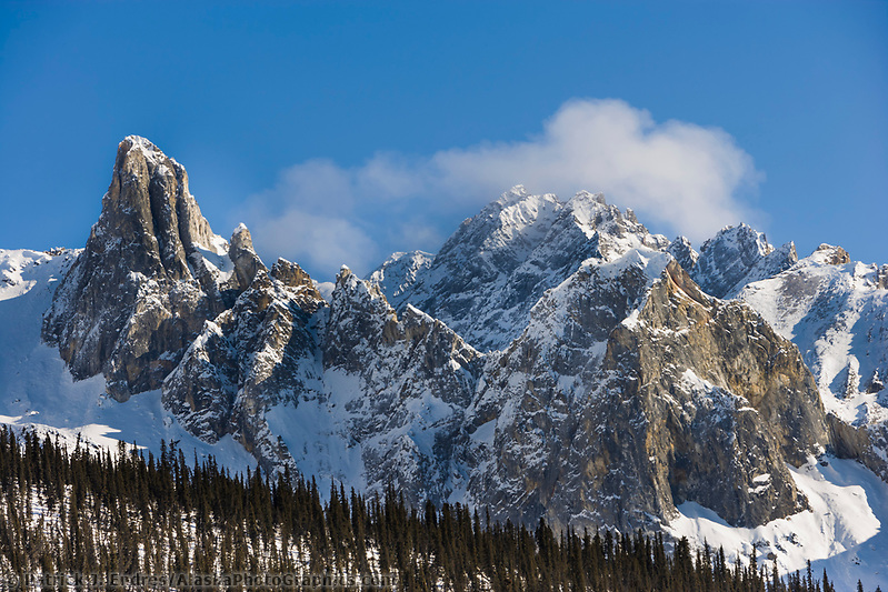
Philip Smith Mountains
Philip Smith mountains of the Brooks Range, Arctic, Alaska. (Patrick J. Endres / AlaskaPhotoGraphics.com)
Endicott Mountains
Atigun River number two, the Endicott Mountains of the Brooks Range, Arctic, Alaska. (Patrick J. Endres / AlaskaPhotoGraphics.com)
Davidson Mountains
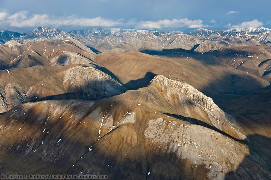
Aerial of the Davidson Mountains of the Brooks Range, Arctic National Wildlife Refuge, Alaska. (Patrick J. Endres / AlaskaPhotoGraphics.com)
Baird Mountains
Ahnewetut Creek flows through the Great Sand Dunes in the Kobuk Valley National Park, Arctic, Alaska. (Patrick J Endres / AlaskaPhotoGraphics.com)
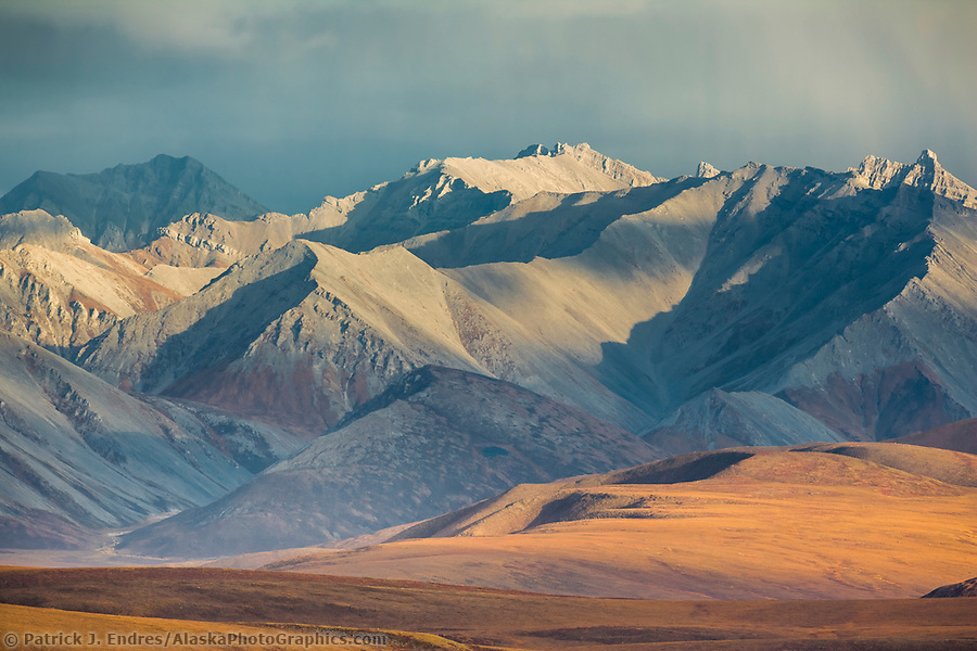
Notable Peaks
Mount Sukakpak
The immense expanse of the Brooks range contains a fantastic array of mountain peaks, most of which require access via airplane or river to witness. However, within the view of the road, there are many dramatic mountain scenes. Mount Sukakpak is known for its distinctive shape and changing appearance since it can be viewed from three angles due to the winding road.
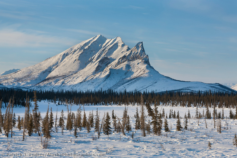
Mount Sukakpak, Brooks Range, Arctic, Alaska. (Patrick J. Endres / AlaskaPhotoGraphics.com)
Mount Snowden
Mount Snowden, located south of Atigun Pass, has a distinctive spire that creates a striking vertical face, often accented by dramatic lighting. Mount Snowden, according to Bob Marshall in his book “Arctic Village,” says that the mountain was named after Harry Snowden, the English name given to an Inupiat man who lived in Wiseman, Alaska.
Mount Snowden, Brooks Range, Arctic, Alaska. (Patrick J. Endres / AlaskaPhotoGraphics.com)
Mount Igikpak
Summit of Mt. Igikpak in clouds, Brooks Range, Gates of the Arctic National Park, Alaska (Patrick J Endres / AlaskaPhotoGraphics.com)
Mount Xanadu and Arial, Arrigetch Peaks
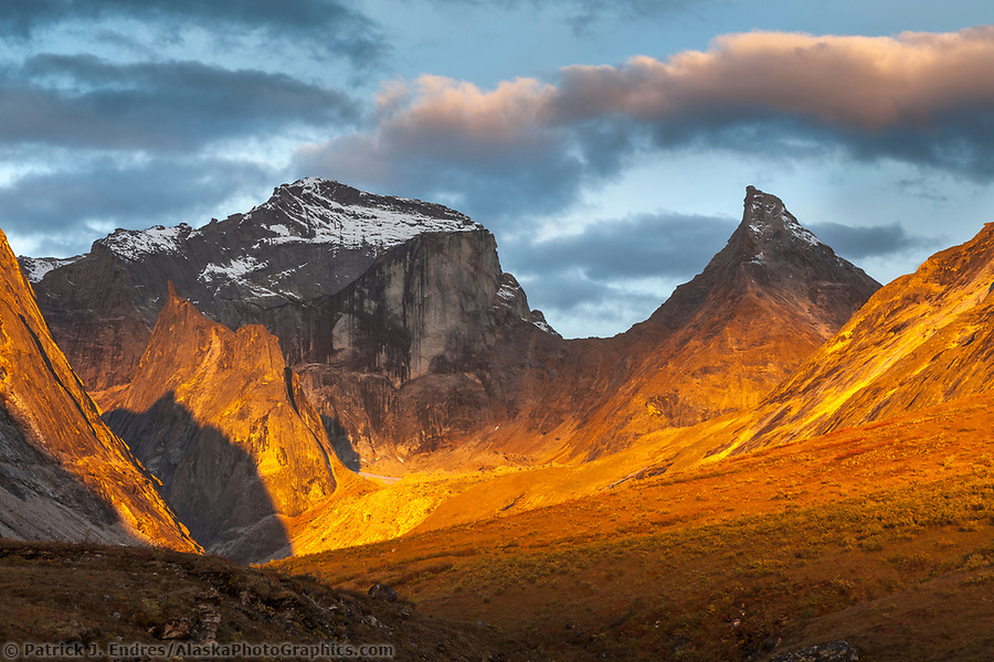
Morning light on Xanadu and Arial peaks, Gates of the Arctic National Park, Alaska. (Patrick J Endres / AlaskaPhotoGraphics.com)
Communities
Only a hand full of tiny communities are located in the Brooks Range. These include the native villages of Arctic Village and Anaktuvuk Pass. In addition, the historic communities of Coldfoot, Wiseman, Bettles, and Chandalar Lake are scattered throughout the area.
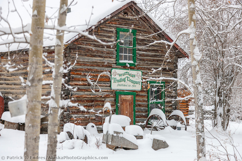
Historic general store log cabin in winter, Wiseman, Arctic, Alaska. (Patrick J. Endres / AlaskaPhotoGraphics.com)
Wildlife
Despite the rugged terrain and far north latitude, some wildlife flourishes in and near the Brooks Range Mountains. Dall sheep seem at home on the rocky slopes. Grizzly bears, moose, red fox, lynx, snowshoe hare, and the migrating herds of barren ground caribou all inhabit the mountainous region.
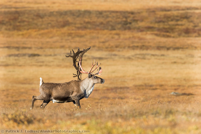
Bull caribou, Rangifer tarandus, prances across the tundra north of the Brooks Range, Arctic, Alaska. (Patrick J Endres / AlaskaPhotoGraphics.com)
Despite the rugged terrain and far north latitude, some wildlife flourishes in and near the Brooks Range Mountains. Dall sheep seem at home on the rocky slopes. Grizzly bears, moose, red fox, lynx, snowshoe hare, and the migrating herds of barren ground caribou all inhabit the mountainous region.
Pipeline
The Trans-Alaska oil pipeline originates in Prudhoe Bay and terminates in Valdez. To complete this 800-mile journey, the pipeline crosses the Brooks Range Mountains through Atigun Pass.
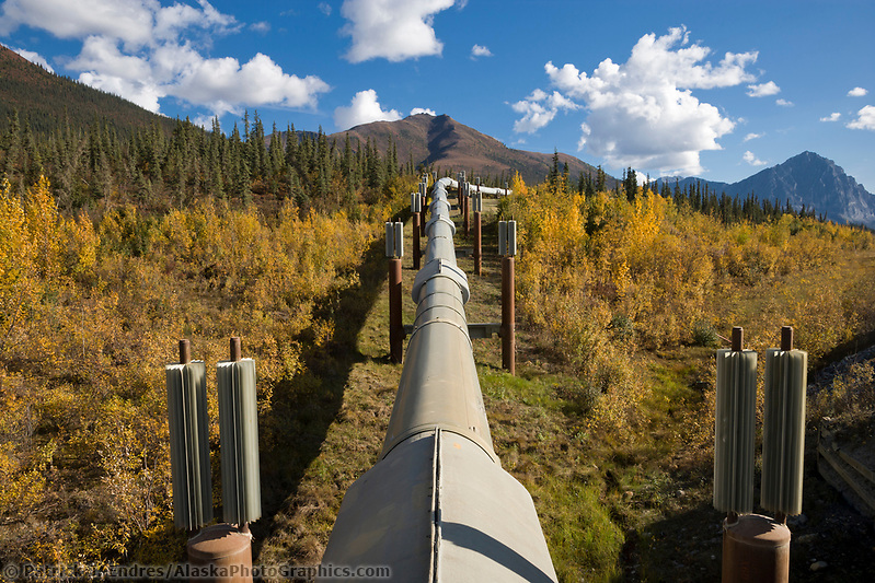
Trans Alaska Oil Pipeline and a close-up view of fins that help keep permafrost ground frozen beneath the pipeline. (Patrick J. Endres / AlaskaPhotoGraphics.com)
Haul Road / Dalton Highway
The James Dalton Highway, commonly called the Haul Road, provides access to Prudhoe Bay from the Elliot Highway near Fairbanks. This highway of mixed gravel and paved road surfaces is a trucker’s domain and the only road supply route to the north slope oil fields. Conditions are generally good, but heavy snow and rainy weather can severely limit and sometimes prevent access. It is maintained by the State of Alaska, with numerous road maintenance camps along the route.
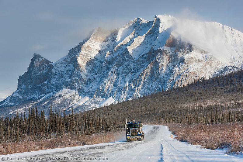
Semi-tractor trailer travels the James Dalton Highway (the haul road) with mt Sukakpak rising in the distance. (Patrick J Endres / AlaskaPhotoGraphics.com)